Bossiney Haven Beach
Location:
North Cornwall.Description:
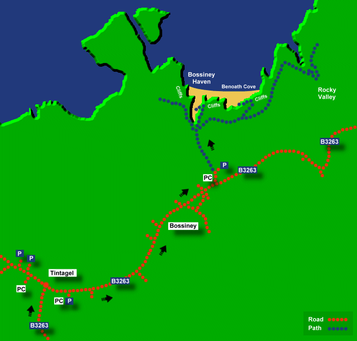
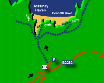
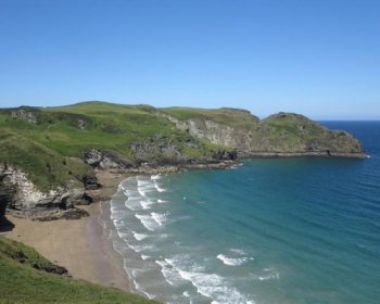
Bossiney Haven is a small pleasant sandy cove below steep cliffs, on the North Cornwall coast. At low tide, the beach extends east to nearby Benoath Cove. The beach is completely underwater at high tide. There is good coast path walking east to Rocky Valley, which is a narrow valley with impressive cliffs. Update 2022 - Bossiney Haven is now closed due to unstable cliffs.Safety:
Strong rip currents. No lifeguards. See Beach Safety Guide.Access:
Access to the beach at Bossiney Haven is via steep steps which are not suitable for wheel chairs or push chairs. These steps are now closed due to a risk of rock falls. At Benoath Cove there are steep steps down with unprotected cliff edges. Benoath Cove can also be reached on the beach from Bossiney Haven.Dogs:
Dogs allowed all year at Bossiney Haven and Benoath Cove.Directions:
Bossiney Haven is approximately 15 miles from Wadebridge. Take the A39 from Wadebridge north to Camelford. At Camelford take the B3266 (signposted to Boscastle) and follow the B3266 out of Camelford. Then turn left onto the B3314 where signposted to Tintagel. Stay on the B3314 for a short distance and then turn right onto the B3263 (signposted to Trebarwith Strand and Tintagel). Continue on this road until Tintagel. At Tintagel turn right (signposted to Bossiney) and follow this road to Bossiney village.Post Code:
PL34 0AY.Parking:
Car parking in a field.Toilets:
Yes by the field car park.Facilities:
None.Activities:
None.Nearby Alternative Beaches:
Polzeath (14 miles, sandy beach, surfing, disabled access)
Crackington Haven (9 miles, sandy beach, surfing, disabled access)
Widemouth (15 miles, sandy beach, surfing, part dog friendly, disabled access)
Bude (18 miles, seaside town with sandy beach, surfing, dog friendly, disabled access)


Photos of Bossiney Haven Beach provided by West Country Views
For more photos of Bossiney Haven Beach, visit Bossiney Haven Photos
For more photos of Bossiney Haven Beach, visit Bossiney Haven Photos