Downderry Beach
Location:
South East Cornwall.Description:
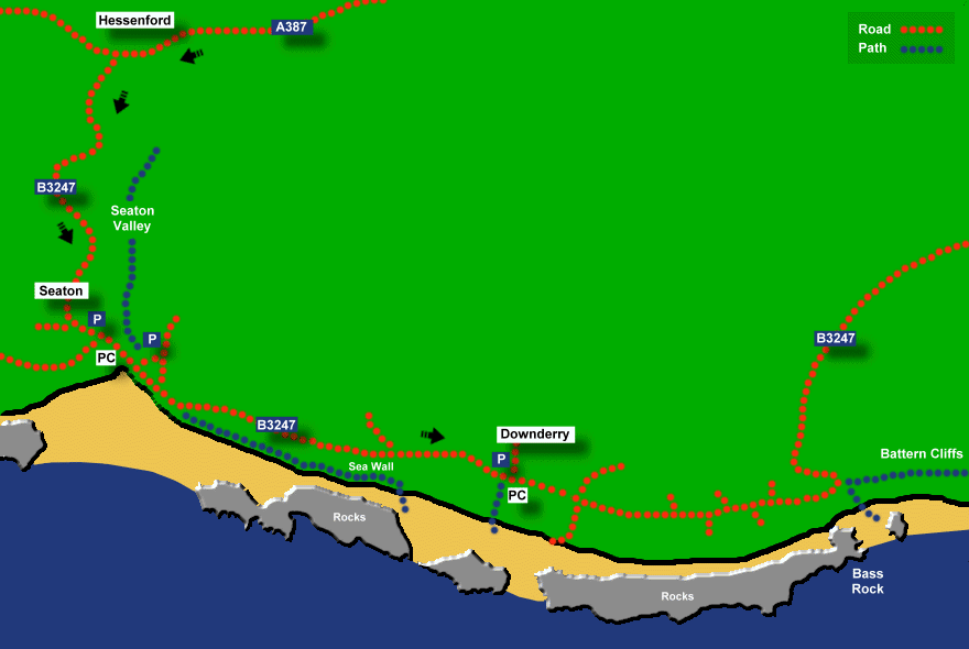
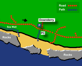
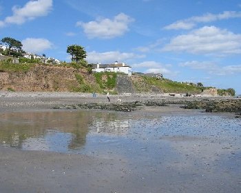
Downderry Beach is a long and spacious sand and shingle beach with many rock pools at low tide. To the east of the main beach, there is an area of rock called Bass Rock and beyond that a half mile stretch of beach below Battern Cliffs. The beach at Battern Cliffs is usually quiet due to difficult access and it has a reputation as an unofficial nudist beach. The car park at Downderry is small but you can also park at Seaton and walk along the beach to Downderry Beach at low tide (taking about 20 minutes).Safety:
Signs warn of strong under currents and falling rocks. Risk of being cut off at high tide at Battern Cliffs. Also a risk of being cut off at high tide if walking between Seaton and Downderry beaches. It's possible to walk along the Seaton sea wall to Downderry Beach, but council signs warn that the wall is not a public highway, the surface is uneven and there is a risk of the sea breaking over the wall at high tide. See Beach Safety Guide.Access:
The main part of Downderry Beach is accessible via a sloping path (next to the toilets) or via the slipway. The path and slipway are too steep for wheelchairs. The beach at Battern Cliffs is accessible by climbing over rocks at Bass Rock and there is also a steep and slippery path from the road.Dogs:
Dogs allowed all year at Downderry Beach.Directions:
Downderry is 18 miles from Plymouth. Take the A38 from Plymouth over the Tamar Bridge into South East Cornwall. At Trerulefoot, turn onto the A374 (signposted to Looe). After about a mile turn right onto the A387 (signposted for Looe, Seaton and Downderry). Follow the A387 to Hessenford and at Hessenford turn left (signposted to Seaton and Downderry) and follow the road down the Seaton Valley towards Seaton. Drive through Seaton and follow the coast road to Downderry. Alternatively park at Seaton and walk to Downderry at low tide.Post Code:
PL11 3LZ.Parking:
1 small car park at Downderry. Larger car parks at Seaton.Toilets:
Yes, opposite the Downderry car park, including disabled facilities.Facilities:
Café, coffee shop, Post Office.Activities:
None.Nearby Alternative Beaches:
Looe (6 miles, sandy beach, disabled access)
Seaton (1 mile, sandy beach, dog friendly, disabled access)
Portwrinkle (3 miles, sandy beach, part dog friendly)
Whitsand Bay (4 miles, sandy beach, surfing, dog friendly)


Photos of Downderry Beach provided by West Country Views
For more photos of Downderry Beach, visit Downderry Photos
For more photos of Downderry Beach, visit Downderry Photos