


Whitsand Bay Beach
Location:
South East Cornwall.Description:
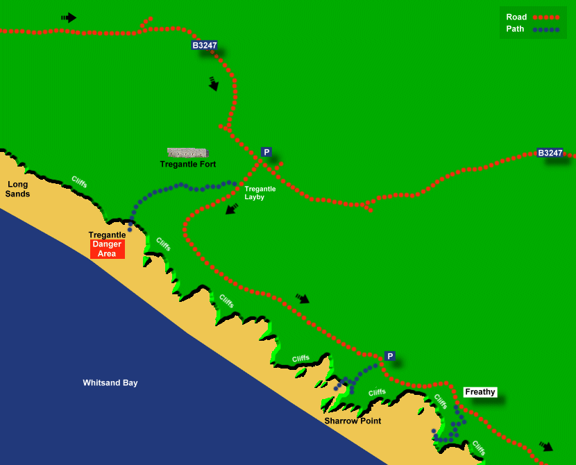
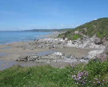
Whitsand Bay is probably South East Cornwall's best beach with a 3 mile stretch of perfect sand but access to the beach at Whitsand Bay is steep and there are limited facilities. Whitsand Bay can be used for surfing but there are rip currents. The western end of Whitsand Bay beach at Tregantle is closed during Tregantle Fort firing range operation.Safety:
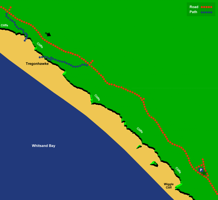
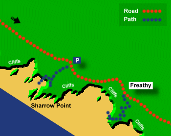
There are rip currents at Whitsand Bay. There are lifeguards between May and September, with flag system in operation. The western part of Whitsand Bay is closed during firing range operation at Tregantle Fort, firing times are indicated by a red flag. The paths to the beach at Sharrow Point, Freathy and Tregonhawke are very steep and slippery. Signs warn of unstable cliffs and falling rocks. There is a risk of being cut off at high tide at Whitsand Bay, so keep close to beach access points. See Beach Safety Guide.Access:
There are a number of access points to the beach at Whitsand Bay. All are steep and are unsuitable for wheel chairs or push chairs. The main access points are at Tregantle, Sharrow Point, Freathy and Tregonhawke all with steep paths, taking about 5 minutes to get to the beach. The path at Tregantle is less steep, but still not suitable for wheel chairs or push chairs. Update August 2020, the path at Sharrow Point is closed after a cliff fall.Dogs:
Dogs allowed all year at Whitsand Bay.Directions:
Whitsand Bay is 24 miles from Plymouth. Take the A38 from Plymouth over the Tamar Bridge into South East Cornwall. At Trerulefoot, turn onto the A374 (signposted to Looe). Two miles after Polbathic turn right onto the B3247 to Crafthole (signposted to Crafthole and Portwrinkle). At Crafthole turn left and continue on the B3247 to Whitsand Bay. After several miles turn right (signposted to Whitsand Bay). Alternatively Whitsand Bay is 7 miles from Plymouth using the Torpoint ferry.Post Code:
PL10 1JW (Sharrow Point car park).Parking:
1 car park and limited layby parking at Tregantle. 1 car park at Sharrow Point. Road parking and field car parking at Tregonhawke. There are also other fields opened for parking in summer.Toilets:
Only at the Eddystone Café Tregonhawke (for café customers only).Facilities:
Cafés at Tregonhawke.Activities:
Surfing.Nearby Alternative Beaches:
Looe (13 miles, sandy beach, disabled access)
Seaton (7 miles, sandy beach, dog friendly, disabled access)
Portwrinkle (3 miles, sandy beach, part dog friendly)
Kingsand And Cawsand (4 miles, sandy beaches, part dog friendly, disabled access)


Photos of Whitsand Bay provided by West Country Views
For more photos of Whitsand Bay, visit Whitsand Bay Photos
For more photos of Whitsand Bay, visit Whitsand Bay Photos