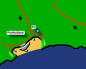
Portholland Beach
Location:
Mid CornwallDescription:
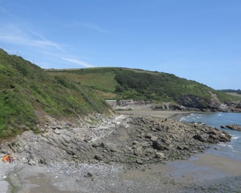
Portholland Beach is a large pleasant sandy beach joining the two hamlets of East and West Portholland. Some rock pools.Safety:
Signs warn of strong undercurrents, large breaking waves, not to use inflatables and risk of rock falls from the cliffs. Also do not bathe when sea is rough and only bathe in the centre of the beach. Also risk of getting cut off at high tide. See Beach Safety Guide.Access:
There is level access to the beach at West Portholland and a short slipway to the beach at East Portholland.Dogs:
Dogs allowed all year at Portholland.Directions:
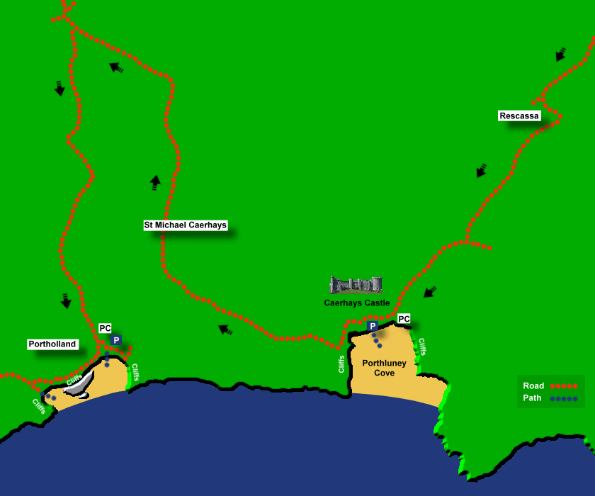
Portholland is about 9 miles from St Austell. Portholland can be difficult to find and there are a number of different routes. From the east the easiest route is probably the B3273. At St Austell take the B3273 for Mevagissey. Shortly after Pentewan turn right on the Gorran Haven road. Continue on this road until Gorran Highlanes and here turn right onto the road to Caerhays (signposted to Rescassa and Caerhays). Follow the road through the hamlet of Rescassa. At the next junction turn right and follow the road to Caerhays Castle and Porthluney Cove. Continue on this road past Porthluney Cove and then continue on this road for a while and then turn left (where signposted to Portholland) and follow the road down to East Portholland. From the west there are routes from the A3078 to West Portholland. On the A3078 a few miles after Tregony, after the Texaco garage there is a signposted left turning to Portholland.Post Code:
PL26 6NA.Parking:
A small car park at East Portholland (about 40 spaces) and a few parking spaces at West Portholland.Toilets:
Yes, at East Portholland.Facilities:
Café at East Portholland www.facebook.com/pebblescafeandcrafts, Post Office open on Saturdays.Activities:
None.Nearby Alternative Beaches:
Pendower Beach (4 miles, sandy beach, dog friendly, disabled access)
Porthluney Cove (3 miles, sandy beach, dog friendly, disabled access)
Hemmick Beach (5 miles, sandy beach, dog friendly)
Vault Beach (6 miles, sand and shingle beach, dog friendly)
Gorran Haven (6 miles, sandy beach, dog friendly, disabled access)


Photos of Portholland Beach provided by West Country Views
For more photos of Portholland Beach, visit Portholland Photos
For more photos of Portholland Beach, visit Portholland Photos