Polkerris Beach
Location:
Mid CornwallDescription:
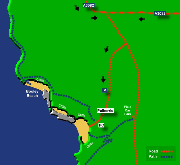
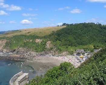
Polkerris is a small village with a stone quay and a pleasant curved sandy beach which can be quite busy in summer. There is also another small beach called Booley Beach which can be reached via a ten minute walk on the coast path. There are no facilities at Booley Beach. Note that the main Polkerris car park fills up quickly in late summer but there is a field car park available.Safety:
Signs warn of unstable cliffs and to watch out for water craft. See Beach Safety Guide.Access:
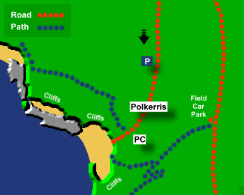
From the car park there is a 5 minute walk along the road down to Polkerris. The return walk is too steep to push wheel chairs. Final access to the beach is via a slipway to the beach. There are steep steps to access Booley Beach.Dogs:
Dogs are banned on Polkerris Beach from Easter Day to October 1.Directions:
Polkerris is about 7 miles from St Austell and 19 miles from Liskeard. Approaching from the east on the A390 turn onto the B3269 for Fowey (this junction is about 2 miles west of Lostwithiel and is signposted to Fowey). Shortly before Fowey turn right at a roundabout onto the A3082 (signposted to St Austell). Continue on this road and then take the next left (signposted to Polkerris and Menabilly) and then turn right and follow the road down to Polkerris. Polkerris can also be reached from the Par direction (on the A3082).Post Code:
PL24 2TL.Parking:
1 small car park less than a 5 minute walk from Polkerris Beach. There is also a field car park open in summer, for this car park do not turn right for Polkerris but proceed on the Menabilly road for a short distance to the field car park. From here there is a track down to Polkerris, taking 5-10 minutes to walk.Toilets:
Yes at Polkerris.Facilities:
Pub, beach shop at Polkerris Beach.Activities:
Watersports, see The Polkerris Beach Company.Nearby Alternative Beaches:
Carlyon Bay (5 miles, large sandy beach)
Par Sands (2 miles, sandy beach, dog friendly, disabled access)
Polridmouth (2 miles, sandy beach, dog friendly)
Readymoney Cove (3 miles, sandy cove)


Photos of Polkerris Beach provided by West Country Views
For more photos of Polkerris Beach, visit Polkerris Photos
For more photos of Polkerris Beach, visit Polkerris Photos