

Godrevy Beach
Location:
West Cornwall.Description:
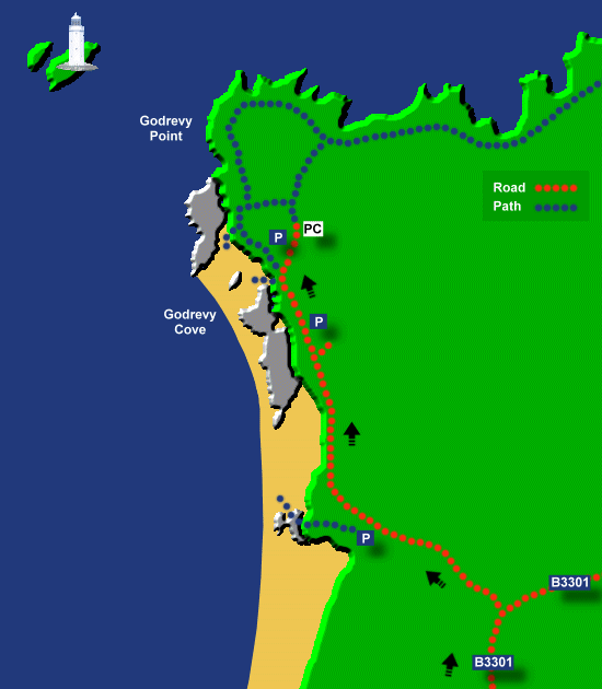
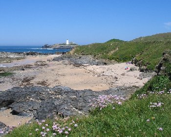
Godrevy Beach is a sandy beach stretching from Gwithian Towans along the Godrevy coastline up to Godrevy Point. On Godrevy Beach there are many rocky sections but also many good sandy patches. The coastline here is run by the National Trust. There are excellent views to Godrevy Island and across St Ives Bay on a clear day and there is also good walking around Godrevy Point.Safety:
National Trust signs warn of strong under currents, not to swim and unstable cliffs. There is also a risk of being cut off by the tide. See Beach Safety Guide.Access:
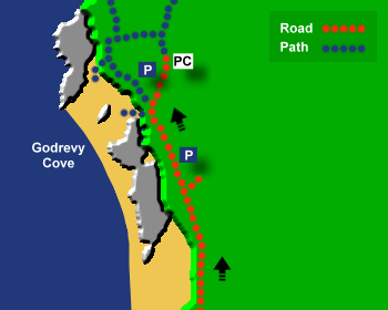
Access to the beach is via sloping paths. Parking is close to the beach.Dogs:
Dogs are banned on Godrevy Beach from 1st July to 31st August (10am to 6pm).Directions:
Godrevy Point is about 4 miles from Hayle and 20 miles from Truro. Approach Hayle on the A30 from east or west. At the Loggans Moor roundabout take the turning for Hayle. Shortly after the roundabout there is a double roundabout. At the 2nd roundabout (of the double roundabout) turn right onto the Gwithian/Portreath road (B3301). Drive through Gwithian and then turn left for Godrevy (signposted to Godrevy).Post Code:
TR27 5ED.Parking:
1 car park just after the Godrevy turning, then a small parking section further up. In summer the National Trust open two fields for parking by Godrevy Point.Toilets:
Yes, by the Godrevy Point field car park, but note these toilets are seasonal.Facilities:
None.Activities:
Surfing.Nearby Alternative Beaches:
St Ives (13 miles, seaside town, sandy beaches, surfing, part dog friendly, some disabled access)
Carbis Bay (7 miles, sandy beach, disabled access)
Porth Kidney Sands (7 miles, sandy beach, dog friendly)
Hayle Beach (4 miles, sandy beach, surfing)
Gwithian Towans (1 mile, sandy beach, surfing)


Photos of Godrevy Beach provided by West Country Views
For more photos of Godrevy Beach, visit Godrevy Photos
For more photos of Godrevy Beach, visit Godrevy Photos